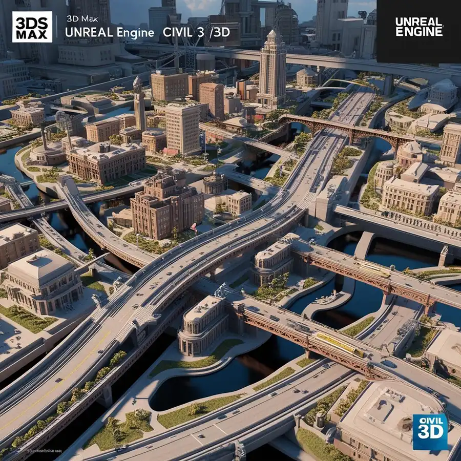
Drone 3D Survey Our services Explore We take your projects to the next level with our comprehensive services in Drone Technology, Precision Mapping, Project Management and 3D Design. Our Services Drone Services Drone ServicesAerial imaging, survey and special video solutions for every industry. Details Surveying Services Surveying ServicesPrecision mapping solutions ranging from land surveys to infrastructure projects. Details CBS Geographic Information Systems (GIS)We support your decision processes with geographic data collection, analysis and visualization. Details Our Services Drone Services Aerial Imaging and MappingWe offer high accuracy mapping, video capture and analysis services for your projects. See Details Project Management and ConsultingExpert Support and Planning We are with you at all stages of your projects. We make your work easier with remote monitoring and reporting. Our Consultancy Services 3D Design and AnimationBring Your Projects to Life We offer comprehensive 3D solutions, from architectural and city models to detailed animations. Explore 3D Solutions World Standards Professional Mapping Services We successfully complete your projects with our team of experts in Qatar, Turkey and Romania. We offer excellence in every detail with our premium service concept. Premium ServiceOn Time DeliveryUnlimited Possibilities Discover the powerful and stunning servicesWe provides you with user management functionality that results in faster development and revenue. Order package Discover the powerful and stunning servicesWe provides you with user management functionality that results in faster development and revenue. Order package Discover the powerful and stunning servicesWe provides you with user management functionality that results in faster development and revenue. Order package Watch Our Success Stories The numbers speak for themselves! We are a reliable leader in the sector with the projects we have completed and the services we offer. Discover our success stories in numbers. 0+Successful Project 0mmSensitizer Underneath 0%Customer Satisfaction